Guidepost

One engine. Four provinces. Your name on the front.

Every place in Atlantic Canada, on one map. Under your brand.

Guidepost is the map and trip planner that tourism boards and visitor-guide publishers run under their own name, inside the website they already have. The base covers Prince Edward Island, Nova Scotia, New Brunswick and Newfoundland and Labrador from public data, kept current by Islandwise. You add your picks, your advertisers and your covers on top. Guidepost appears once, small, at the foot. In English and French.

0places
0scenic drives
0km of road for routing
The map behind this text is live: drag it.

Coverage

The base, before anyone's name is on it

Counted from the data the map ships with, build of 7 November 2026. Drive lines are traced through the towns and landmarks on each route, on the shore and river roads rather than the highway bypass. The nine longest Nova Scotia, New Brunswick and Newfoundland routes are checked against the length the provincial tourism guide publishes and sit within 15% of it. "Services" is the everyday layer a guide leaves out: gas, EV charging, groceries, pharmacies, hospitals, ATMs, laundromats, car rental, airports and ferry terminals. It is off by default and one tap away.

What the map does

Built to be the best tourism map a visitor has used
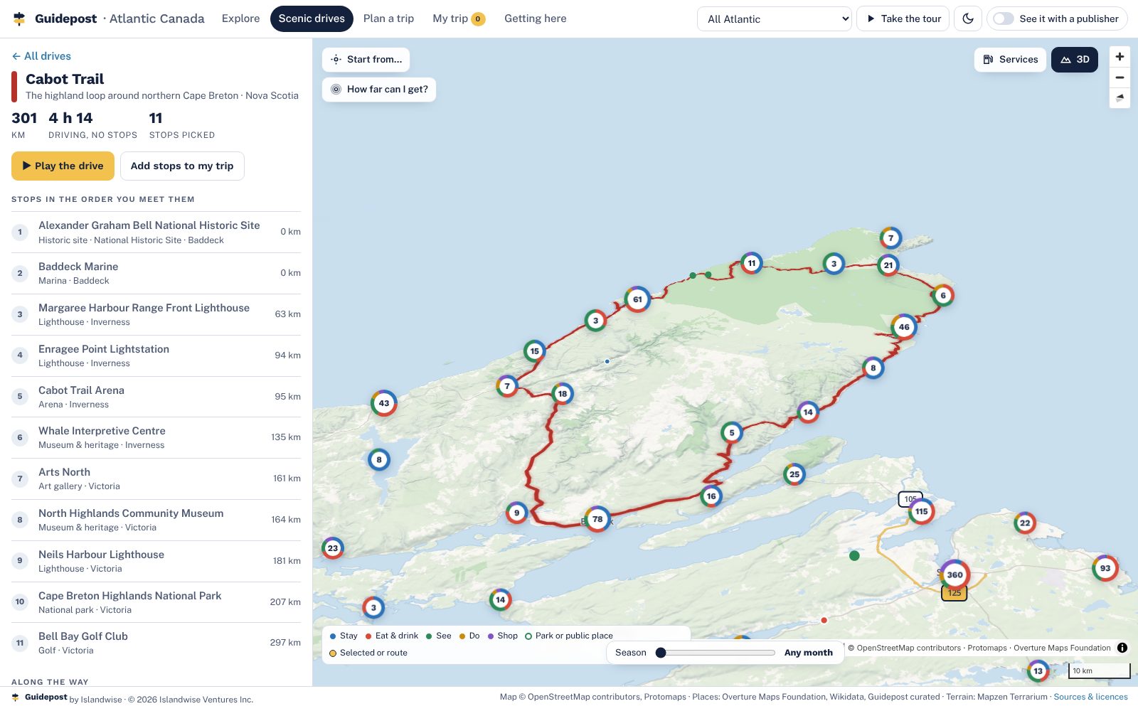
The Cabot Trail drawn in red over 3D terrain of the Cape Breton Highlands, with the drive's stops listed in order
A real map, in 3DVector tiles for all four provinces with hillshade, terrain and buildings you can tilt and turn. Street detail across PEI, Nova Scotia, New Brunswick and the island of Newfoundland, with full town detail in about 400 towns and the main corridors, and finer relief over the Cape Breton Highlands, the Fundy cliffs and Gros Morne. Labrador is mapped at overview detail.
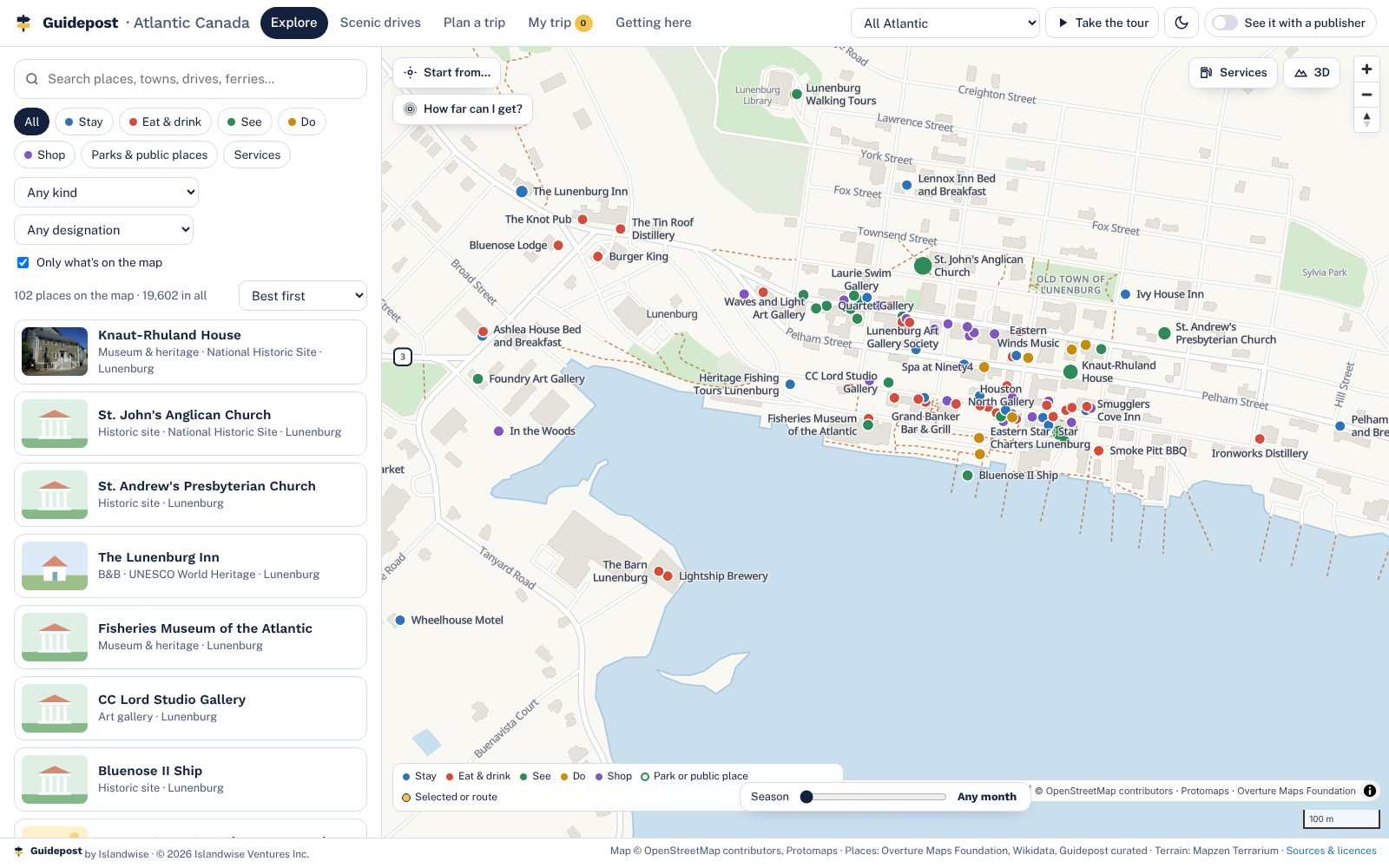
Lunenburg's waterfront at street level, with streets, buildings and Guidepost places labelled clear of each other
Clean all the way inAt street level the map turns to plain paper with crisp streets, buildings, shorelines and labels, in town and country alike. No blurred patches where the data runs out.
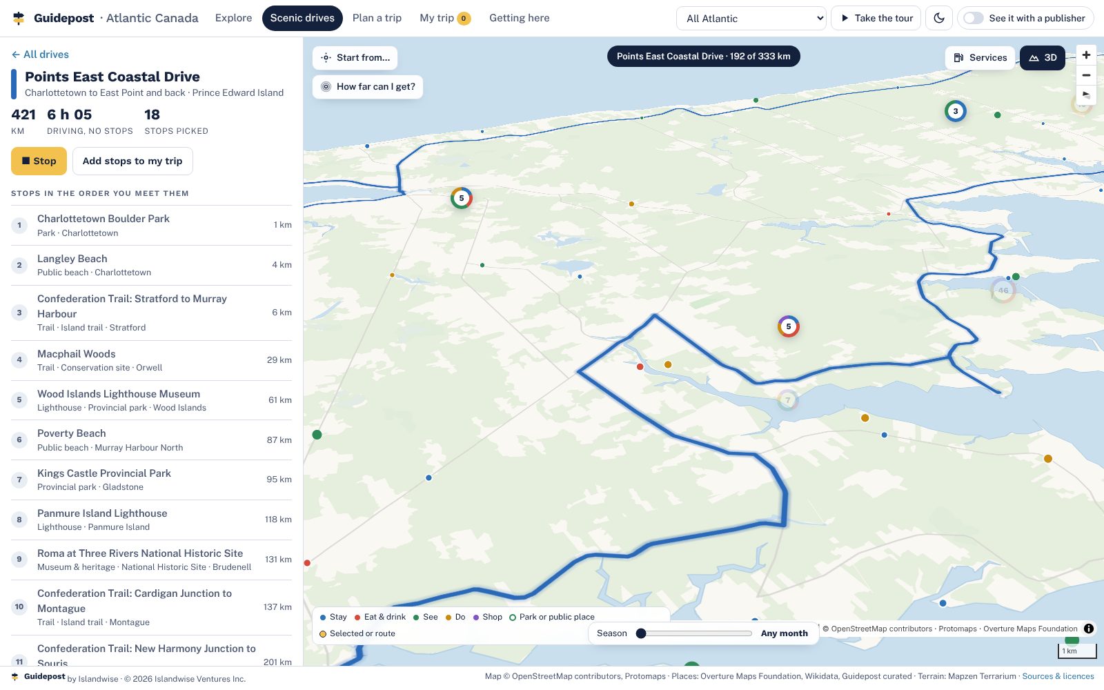
The Points East Coastal Drive being played as a camera flight along the road
26 scenic drives, playedEvery official touring route in the four provinces, with length and drive time from the road network, stops in the order you meet them, and a camera flight along the road.
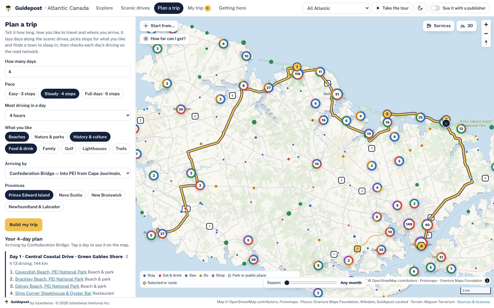
A four-day plan from the Confederation Bridge with a route drawn on the map and a bed each night
A planner that builds the daysLength, pace, interests and where you arrive. It lays days along the drives, finds a town to sleep in, checks each day's driving on the road graph and warns when a day runs long.
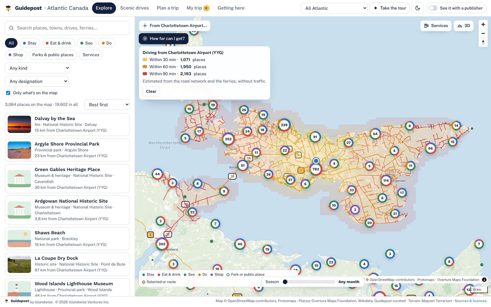
Drive-time rings of 30, 60 and 90 minutes from Charlottetown Airport with the places inside each counted
How far can I get?Thirty, sixty and ninety minutes from any start, bridge and ferries included, with the count of places inside each ring. Worked out in the page, no server.
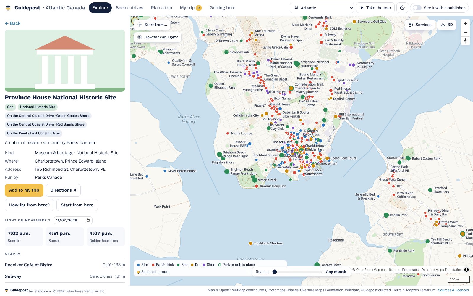
A listing sheet for Province House National Historic Site with sunrise, sunset and golden hour, nearby places and the data source
A listing sheet for every placePhoto with its credit, designation, address, website, season, sunrise and sunset for any date, what's nearby, and exactly where the record came from.
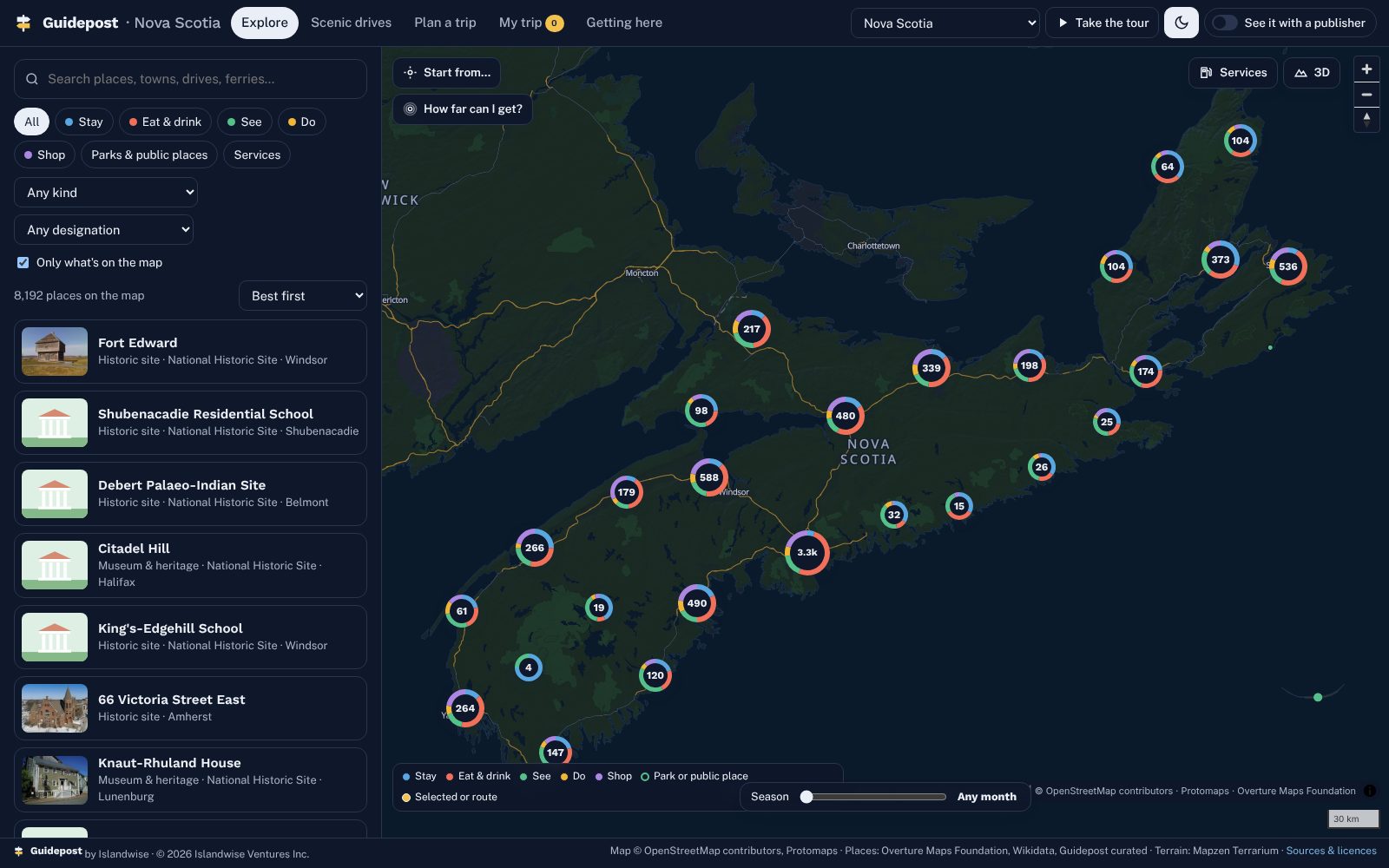
Nova Scotia in dark mode with donut clusters coloured by category
Clusters that tell you what's thereDonuts coloured by stay, eat, see, do and shop that split as you zoom. Light and dark, and a search that forgives typos and accents.
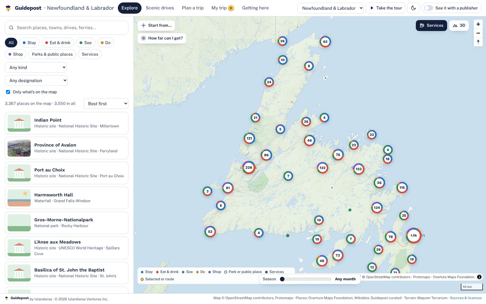
Newfoundland and Labrador with the services layer on
Seasons and servicesA month slider greys out what's closed, where the season is known. A services layer for gas, EV charging, groceries, pharmacies and hospitals, off until you need it.
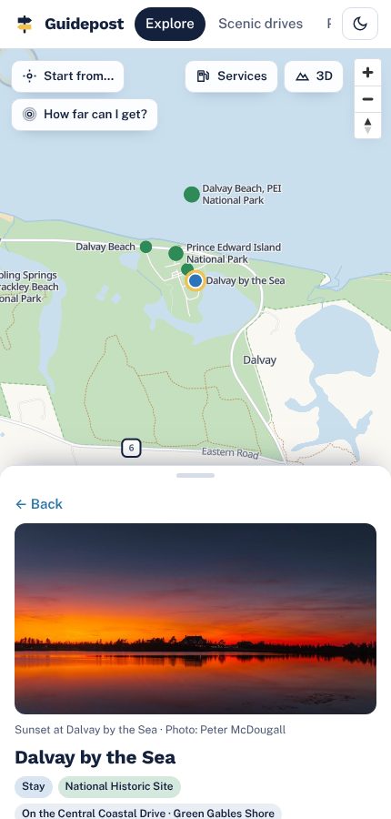
The map on a phone, with the panel as a bottom sheet
Phone first, counter and presenter modesOn a phone the panel is a bottom sheet. A kiosk mode for visitor-centre counters hands a visitor their trip in one scan, and a 90-second scripted tour runs a pitch meeting.

New for 2027

Built for every visitor, from the moment they arrive

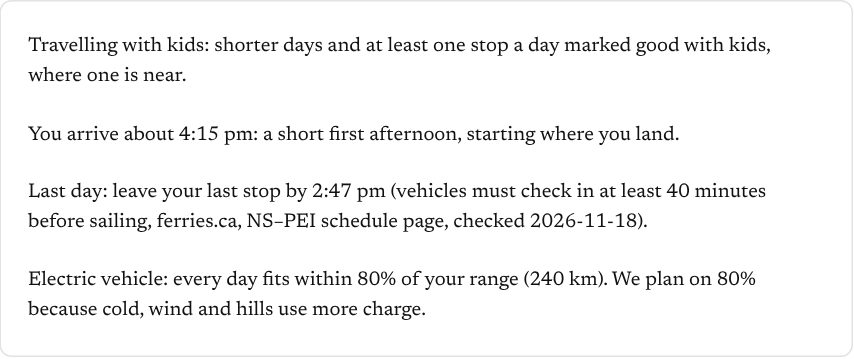
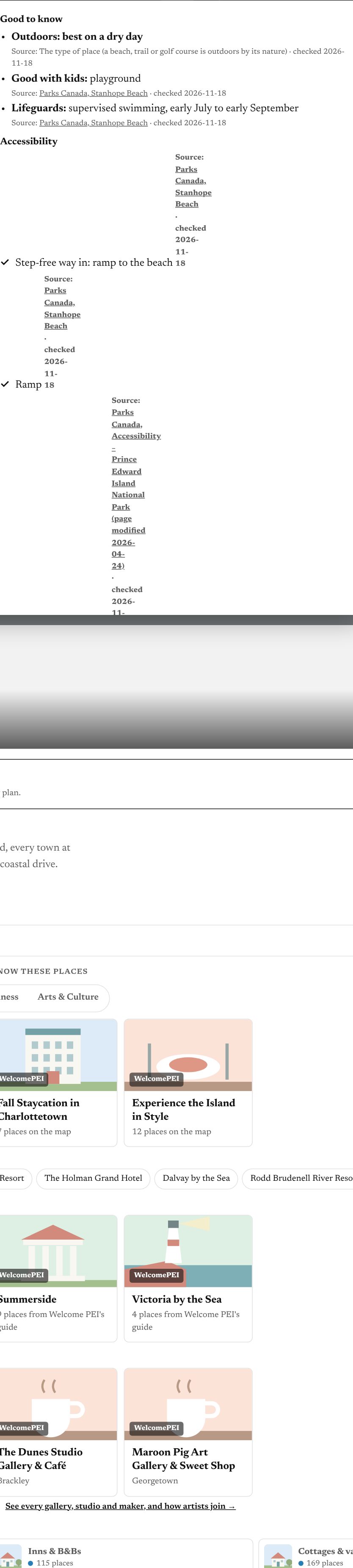
Arrival day, kids, rain, accessibility, electric cars, sunsets and the whole group on one trip. Every detail shown carries its source and the date it was checked; where nothing is known, the planner says "not confirmed".
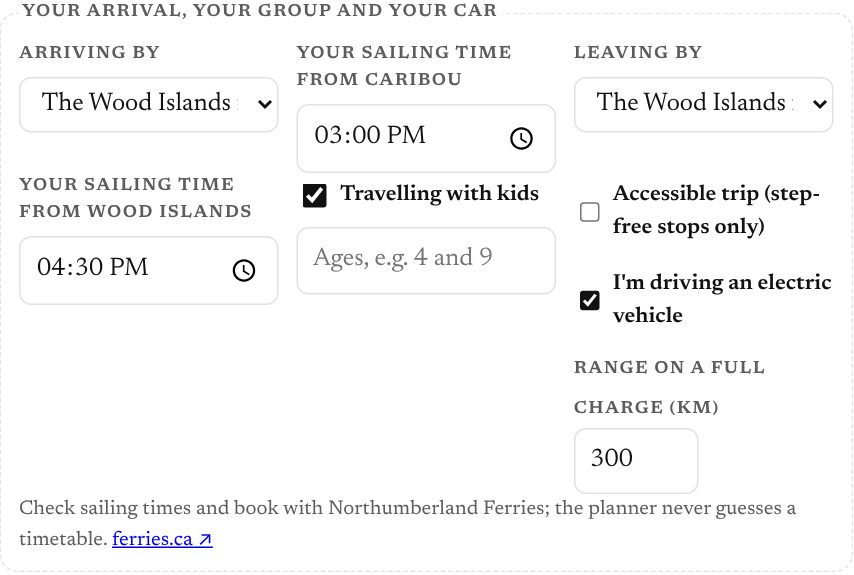
Arrival day and departure day
Arrival day and departure dayThe visitor tells the planner how they arrive and when: the bridge, the Wood Islands ferry, the airport, a cruise ship or the Magdalen Islands ferry. Day one starts where they land; a 7 pm ferry gets supper and a bed. The last day works back from the sailing, using the operator’s published check-in time. The visitor enters their own sailing time: the planner never guesses a timetable.
Kids, rain and accessibility on every listing
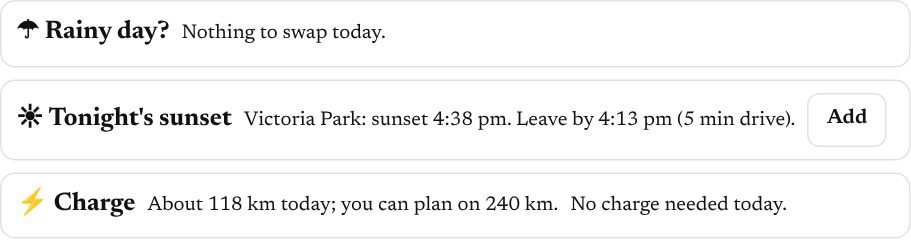
Kids, rain and accessibility on every listingGood with kids, good in the rain, lifeguards, mobility mats, beach wheelchairs, step-free access: each with its source. A rainy-day button swaps outdoor stops for indoor ones nearby, and an accessible-trip switch keeps only stops confirmed step-free. Businesses can add their own details, shown as "from the business" after the licensee checks them.
Electric vehicles and the best time for each beach
Electric vehicles and the best time for each beachThe planner checks each day’s driving against the car’s range, with a margin it explains, and suggests a charger next to a meal. Beaches show sunrise, sunset and golden hour for the visitor’s date, which way they face, and when the tide matters, a link to the official tide table.
One trip for the whole group
One trip for the whole groupShare a trip with an edit link and a view link. When anyone changes it, everyone sees the change and who made it; nothing is lost if two people edit at once. A saved trip and every place on it stays available without a signal. At the visitor centre, the counter hands the trip to a phone in one scan.
Results and demand for the licensee
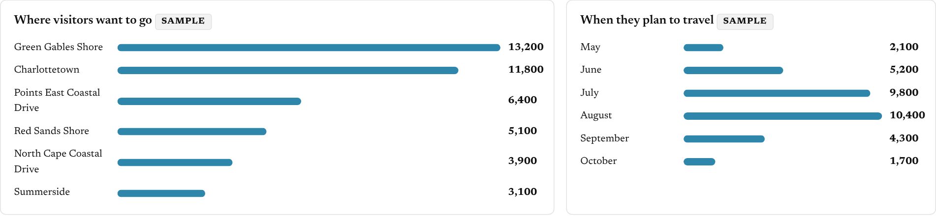
Results and demand for the licenseeReal counts, with no cookies and nothing that identifies a visitor: visits, trips, shares, clicks to each advertiser. A Demand area shows where visitors want to go, when, and what they search for that no listing offers, with branded PDF reports. Figures from fewer than ten visitors are never shown.

Shared trips, live counting and offline maps run on the licensee’s own web address. In the demo they run on sample data or for signed-in viewers, and are labelled so.

Your layer

What a publisher puts on top
You
Picks, deals, tours and guidesYour editors choose what sits on top of the map and when it changes. Your advertisers' offers show on their listings. Your printed guide, page by page, with every listing linked.
You
Advertisers first, with one-tap bookingYour advertisers lead the results in their category and book through the partners they already use. A placement in the guide is worth more than it was.
Both
Counter mode and the QR on every coverA card at the visitor-centre desk and a code on the guide: the visitor scans, the week is on their phone. No app to install.
Us
The base map, hosting and updatesEvery place, the map itself, routing, the planner, the season report. Kept current by Islandwise; you never touch a server.
Where Guidepost shows: once, small, as "powered by Guidepost" at the foot of the planner and on the counter card. Never in your header, never on your cover beyond the QR badge.
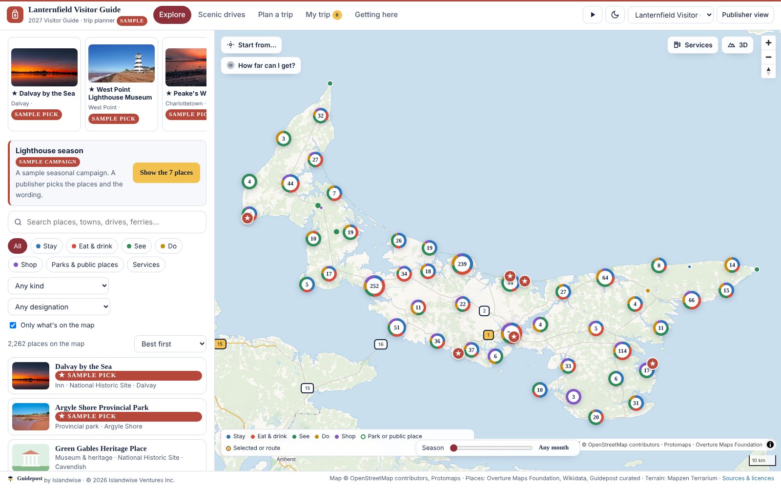
The map under an invented sample brand, Lanternfield Visitor Guide, showing only Prince Edward Island in the brand's colours with a seasonal campaign banner
The live map switched to Lanternfield Visitor Guide, an invented sample brand. One settings file changed the name, logo, colours, province, picks and campaign.

For tourism boards and regions

Already have a website? Keep it.

Guidepost is not a website. It is the map and planner layer that goes inside the one you have, with one line of code. Your site tells visitors what there is. This shows them what is near what, how long the drive is, and builds their days.
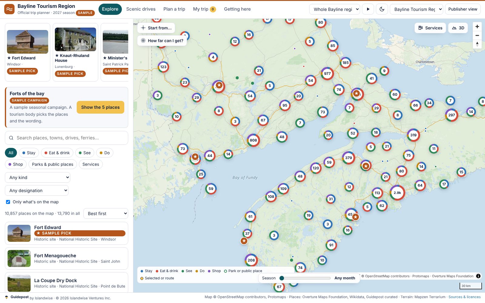
The same map under a second invented sample brand, Bayline Tourism Region, showing Nova Scotia and New Brunswick in teal
The same engine as Bayline Tourism Region, a second invented sample brand covering two provinces. Switch between brands yourself in the live map's header.
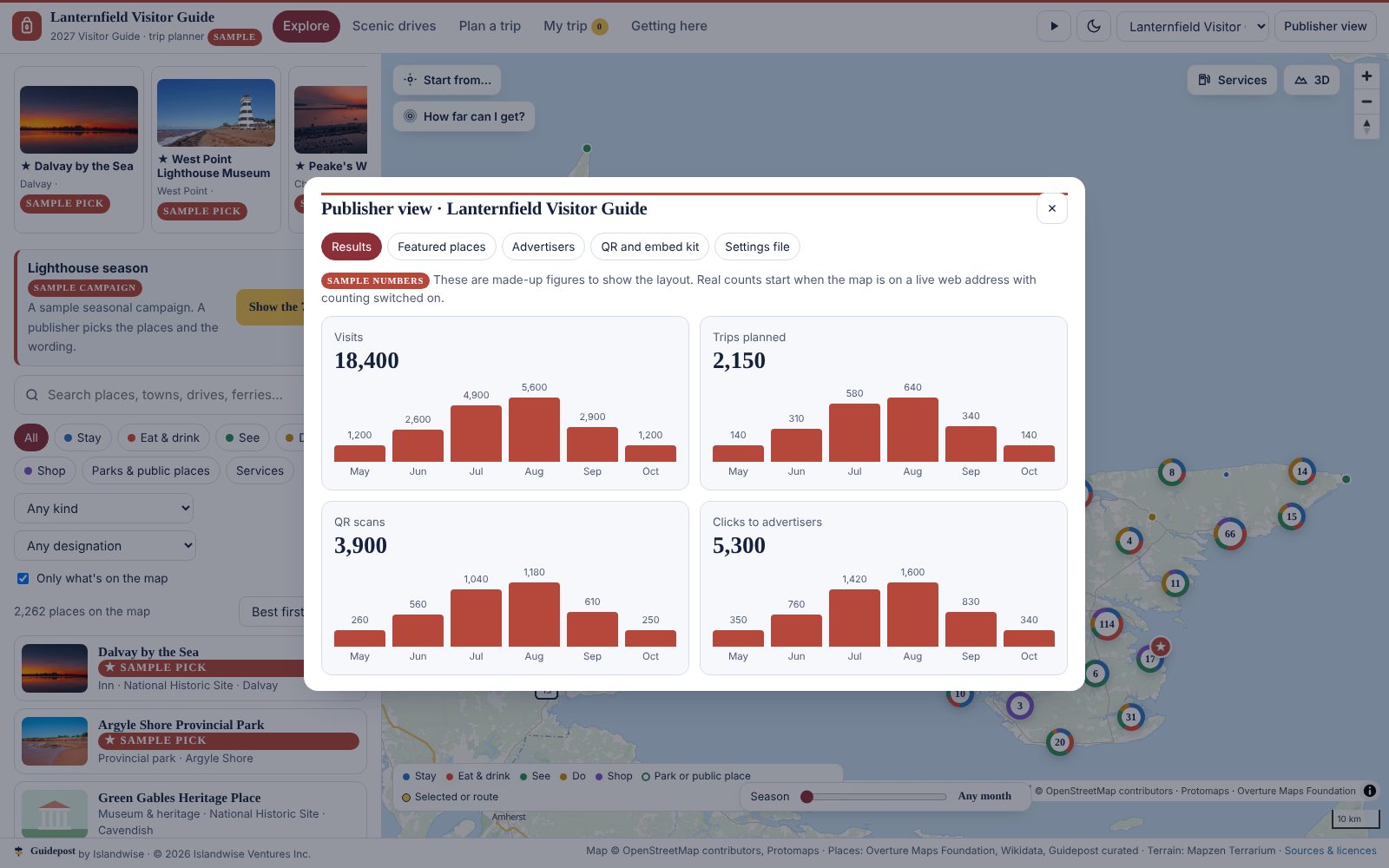
The publisher view showing four sample numbers: visits, trips planned, QR scans and clicks to advertisers, with a monthly chart
The publisher view: visits, trips planned, QR scans and clicks to advertisers. The numbers shown are samples and are labelled so; real counting starts when the map is live on your own web address.
What changes per brand: name, logo, colours, fonts, which provinces show, the opening view, featured places, advertisers, ready-made trips and seasonal campaigns. What you get with it: a QR code for any place, drive or trip, the embed code, and a launch kit with poster, counter card, social posts and a staff guide.

How a region comes on

A setup over one off-season, not a rebuild

1

The base map

Your region's base is already built. We check it with you: every place a visitor might need, the map, the drives. You see it before you decide anything.

Weeks 1 to 4
2

Your layer

Your listings, picks and covers go in; your colours and your name go on the front. Your editors learn the admin in an afternoon.

Weeks 4 to 8
3

Your advertisers

Each advertiser's listing is checked with them, their offers and booking links connected. We don't take a cut of the booking.

Weeks 8 to 14
4

Live for opening day

Covers printed with the QR, counter cards at the centres, live for the season. A season report at the end, written so you can renew with it.

Season

Licensing

In plain words

  • A setup, then a yearly licence. The licence is how we're paid; there is no booking fee.
  • Exclusive to one publisher per region while the licence is active.
  • Your brand on the front; Guidepost once and small at the foot.
  • Your listings, advertisers and visitor data are yours, exportable any day.
  • Hosting, updates, routing and the base map are ours to keep current.
  • A season report every year.
TermHow it works
SetupOne off-season: your layer, advertisers, covers, counter cards on the finished base
LicenceYearly, with a minimum term; renewals keep the region exclusive
Region exclusivityOne publisher per region while the licence is active
Brand placementYours on the front; "powered by Guidepost" at the foot
DataYours, exportable
Hosting and updatesIncluded
BookingsGo to your partners; no fee taken

Who it's for

Anyone who owns a region's visitors

Visitor-guide publishersThe printed guide, in the visitor's pocket, with every advertiser's listing linked and a QR on the cover.
Destination organisationsOne planner for a province or a region, at the visitor centres and on the signs, with the base kept current for you.
Festivals and eventsFans keep your app for the weekend; the planner takes care of the rest of their trip, with group itineraries to share.
Tour operators and resortsA small licence puts your tours and your property's own picks on the same map your guests are already using.

Data, sources and privacy

Where the base comes from

Sources

  • Map. OpenStreetMap contributors, in the Protomaps basemap build of 4 November 2026 (ODbL).
  • Places. A hand-checked Guidepost core for PEI; Overture Maps Foundation places (release 2026-10-21, CDLA Permissive 2.0); Wikidata for lighthouses, parks, historic sites and museums (CC0); photos from Wikimedia Commons under the licence shown on each.
  • Roads for routing. Overture Maps transportation, with the Confederation Bridge and the ferry crossings.
  • Terrain. Mapzen Terrarium elevation tiles.
  • Scenic drives. Route names and directions from Tourism PEI, Tourism Nova Scotia, Tourism New Brunswick and Newfoundland and Labrador Tourism; lines follow the main road between the towns on each route.

How it is kept current, and what it never does

  • The base is rebuilt from the sources each off-season; every listing shows its source and the date it was pulled.
  • Hours, prices and reviews are not in the base: the map never invents them, and a publisher's layer can add what it stands behind.
  • Ferry sailings and tide times link to the operators and to the official tide tables; they are never guessed.
  • No visitor tracking in the base map. A visitor's trip lives in their own browser until they choose to copy it.
  • No app to install, nothing to sign up for.

Today

Where it stands

First region

Prince Edward Island. The first publisher on PEI goes live for the 2027 season; the Atlantic base is built and open above.

Where next

Nova Scotia, New Brunswick, Newfoundland and Labrador

The base is already built for each. A publisher there starts at step two.

Islands and ferry regions

Places a visitor arrives at by ferry or bridge and plans a whole week around.

Destinations with a guide

Any publisher with a printed guide, a visitor centre and advertisers to renew.

About

Guidepost by Islandwise

Charlottetown, Prince Edward Island. Owned by Islandwise Ventures Inc.

Islandwise builds one visitor platform and sets it up for the publishers, destinations and resorts that own a region's tourism. Guidepost is the destination planner: built on PEI from public data, now covering all of Atlantic Canada, with its first publisher signing for the 2027 season.

Founder Peter McDougall grew up around the Island's golf and hospitality businesses and started the company because the places visitors needed were in the guide, and the guide wasn't in their pocket.

Contact

Tell us about your region

The guide, the visitor centres, the advertisers. Your region's base map is already built, so we can walk you through it on a call and come back with what a licence would cost.

[email protected]

Peter McDougall · Islandwise Ventures Inc.